
MIAMI COUNTY — A tornado touchdown in Miami County from Monday night’s storms likely won’t be confirmed until Wednesday, according to the National Weather Service.
According to Myron Padgett, a meteorologist with the National Weather Service in Wilmington, there is a high probability that a tornado did touch down in the county, however, because there is widespread damage in the state, a survey team from the NWS likely will not make it to Miami County until Wednesday morning to confirm the tornado. In the meanwhile, Padgett said the Miami County Emergency Management Agency was assessing the damage on Tuesday and sharing its findings with the NWS.
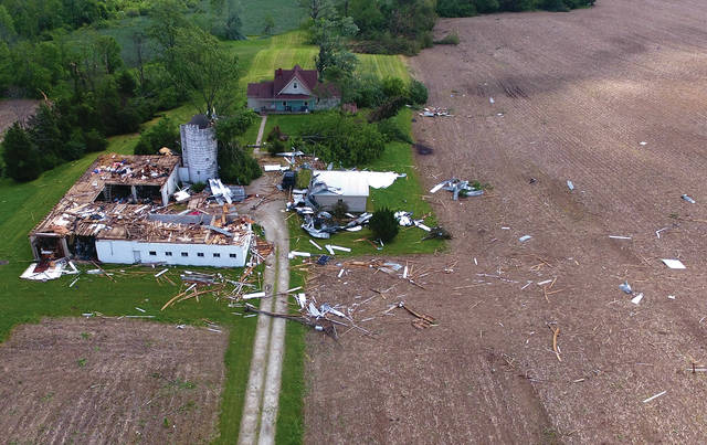
“Most of the damage was probably from a tornado that touched down,” Padgett said. “It is highly likely that there was a tornado. The Ludlow Falls, Laura area was at the stronger end of it.”
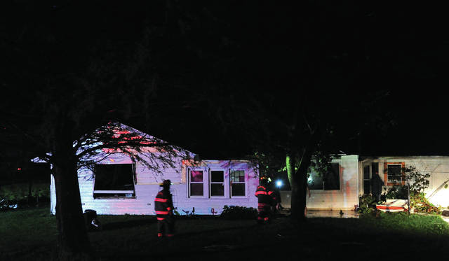
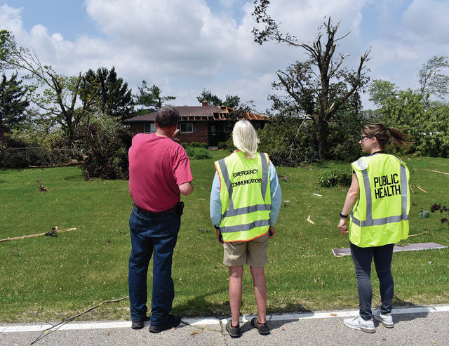
Miami County Public Health Emergency Preparedness Coordinator Nate Bednar, RS, said the Miami County Emergency Management Agency, along with several other county and municipal agencies, are responding to Monday’s severe weather outbreak. Damage assessment teams have been sent to the most heavily impacted areas in Miami County, which include Potsdam, Laura, Ludlow Falls and West Milton and the surrounding areas.
“These teams will be looking for, and noting, any heavily damaged or destroyed homes or buildings to help direct recovery efforts,” Bednar said in a press release.
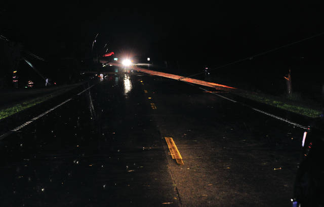
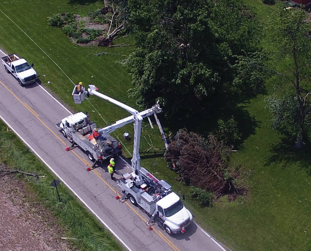
There are several road closures in the area due to downed power lines, debris and flooding. All motorists must heed warning signs and avoid these areas, Bednar said. Bednar said not approach downed or low hanging power lines and report them immediately to the power company.
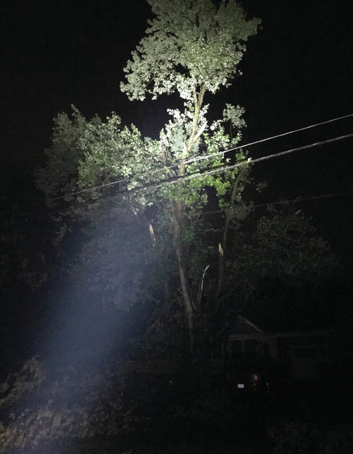
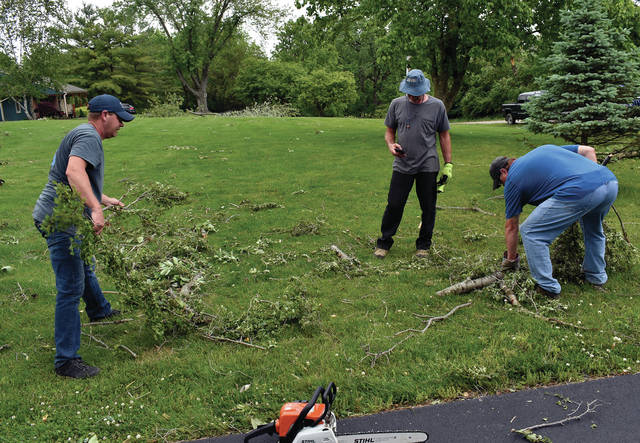
“Also be sure to use caution and avoid areas where trees may be damaged or weakened as the trees or branches may be unstable and unsafe,” Bednar said.
Survey teams were headed to Mercer, Montgomery, Pickaway and Greene counties in Ohio on Tuesday, according to the NWS website.
Padgett said several simultaneous storms were in the area Monday night, spawning what is believed to be multiple tornadoes in the state.
According to Padgett, the storms hit between 10 p.m. and midnight and locally began in the southwestern part of Miami County between Troy and Tipp City. The tornadic activity likely touched down in the Laura and Ludlow Falls area based on damage reports.
“There are reports of houses damaged, trailers flipped over in the southwestern part of the county, trees down and other minor damage,” Padgett said.
The National Weather Service on Monday evening reported cloud rotation and possible tornadoes in eastern Indiana, and with those storms came reports of a possible tornado in the Ludlow Falls, Laura and Potsdam area. The storm, reportedly moving northeast at 35 miles per hour, left a path of destruction throughout Union Township and portions of Monroe Township.
Even before the tornado sirens stopped, firefighters from West Milton, Ludlow Falls, Laura and Pleasant Hill began the task of going door-to-door in the damage path, checking on residents, according to reports. A number of homes and house trailers in the area sustained damage or were destroyed by winds. Trees and power lines were ripped from the ground, knocking out power to many and blocking roadways, making welfare checks more difficult for first responders.
Flooding was reported across many roadways in the area of the storm. The Troy Fire Department responded to calls on Interstate-75 after motorists reportedly hydroplaned off the highway and became stranded in high water.
Medic crews were kept busy as they moved from call to call. Several calls for medic service came in, including an evacuation of McKinley Commons Senior Apartments in West Milton where the loss of power put residents who were on oxygen in jeopardy.
Darkness, coupled with widespread loss of electric, hindered efforts to check on those who were in need of assistance Monday night.
A shelter was set up in West Milton to house those displaced by the storm.
The American Red Cross is assisting those in need of housing assitance due to the storm and can be reached at (800) 733-2767.


